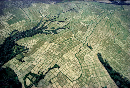
As a final presentation for my Persian language course, I recently made a PowerPoint about Iran's diverse geography and landscape. I used several images from one of my favorite photography books-- Paradise Lost: Persia from Above by Georg Gerster. Between 1976 and 1978 (right before the Islamic revolution) Gerster was granted rare permission from Queen Farah Pahlavi to record the landscapes and cities of Persia through aerial photography. My favorite photos are those of old citadels and oases irrigated through qanats (see the last image). The title suggests that 'paradise' is lost because since 1979 no one has been able to document Iran's geography this thoroughly-- in fact, the only aerial imagery we see today from Iran are poor-quality photos of nuclear facilities. Several of Gerster's images also document many places that have been destroyed by earthquakes since the 70s-- making Gerster's project even more valuable. Highly recommended for anyone interested in Iranian history, agriculture, and art.
The word 'paradise' is derived from the the ancient Iranian word--'paridayda' in Old Persian (rendered 'parádeisos' in Ancient Greek) which was meant to describe an oasis or cultivated area. The ability to channel water into the deserts was indeed one of the most transformative engineering feats of ancient Iranians and was deemed sacred. The ancient gardens of Cyrus the Great were therefore called 'paridayda'.


No comments:
Post a Comment